
National Recreation Area · Colorado, United States
Curecanti National Recreation Area
Curecanti National Recreation Area is a national recreation area in Colorado, United States, covering 43,591 acres (17,640 ha), established in 1965.
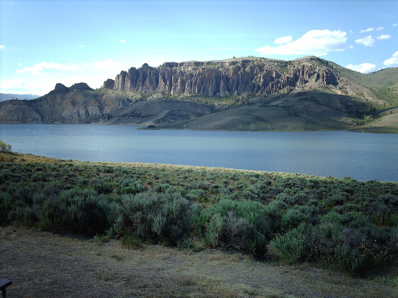
Photo: The original uploader was Nationalparks at English Wikipedia . via Wikimedia Commons, CC BY-SA 2.5. Cropped and resized for display.
Park facts
| Park type | National Recreation Area |
|---|---|
| Location | Colorado, United States |
| Area | 43,591 acres (17,640 ha) |
| Established | 1965 |
| Coordinates | 38.4547° N, 107.3270° W |
| Managed by | National Park Service |
Every fact above is taken from the sources listed below; anything no source states is left blank rather than guessed.
About Curecanti National Recreation Area
Curecanti National Recreation Area (Pronounced (locally) or .) is a National Park Service unit located on the Gunnison River in western Colorado. Established in 1965, Curecanti National Recreation Area is responsible for developing and managing recreational facilities on three reservoirs, Blue Mesa Reservoir, Morrow Point Reservoir and Crystal Reservoir, constructed on the upper Gunnison River in the 1960s by the U.S. Bureau of Reclamation to better utilize the vital waters of the Colorado River and its major tributaries.
Description from the park's Wikipedia article (CC BY-SA), linked in the sources below.
Planning your visit
What to do
Where to stay
| Campgrounds | Yes |
|---|
Like Curecanti National Recreation Area? Visit Curecanti National Recreation Area’s official park page for hours and current conditions before you travel.
Airports near this park
The airports a visitor would actually fly into, nearest first — each link opens its profile on our sister site AirportProfiles.
- City of Colorado Springs Municipal Airport (COS) · Colorado Springs, United States · 143.8 miles away
Parks nearby
More parks in Colorado

Frequently asked questions
Where is Curecanti National Recreation Area?
Curecanti National Recreation Area is in Colorado, United States (38.4547° N, 107.3270° W).
When was Curecanti National Recreation Area established?
Curecanti National Recreation Area was established in 1965, per the source listed at the foot of this page.
How big is Curecanti National Recreation Area?
Curecanti National Recreation Area covers 43,591 acres (17,640 ha).
Does Curecanti National Recreation Area have campgrounds?
Yes — Curecanti National Recreation Area has campgrounds.
Sources
- https://en.wikipedia.org/wiki/List_of_the_United_States_National_Park_System_official_units — Wikipedia list of National Park System official units — unit name, state, official designation.
- https://en.wikipedia.org/wiki/List_of_areas_in_the_United_States_National_Park_System — Wikipedia list of National Park System areas — year established and gross area.
- https://en.wikipedia.org/wiki/Curecanti_National_Recreation_Area — Wikipedia article — description (CC BY-SA).
- https://www.nps.gov/cure/ — Official park page.