
State Historic Site · New Hampshire, United States
Fort Constitution State Historic Site
Fort Constitution State Historic Site is a state historic site in New Hampshire, United States, covering 2.0 acres (0.8 ha).
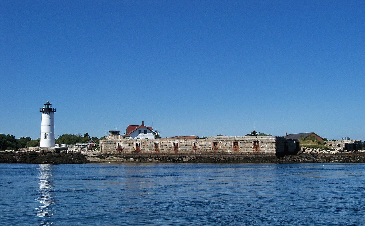
Photo: AlexiusHoratius via Wikimedia Commons, CC BY-SA 3.0. Cropped and resized for display.
Park facts
| Park type | State Historic Site |
|---|---|
| Location | Rockingham, New Hampshire, United States |
| Area | 2.0 acres (0.8 ha) |
| Coordinates | 43.0713° N, 70.7102° W |
| Managed by | New Hampshire state park system |
Every fact above is taken from the sources listed below; anything no source states is left blank rather than guessed.
About Fort Constitution State Historic Site
Fort William and Mary was a colonial-era British fortress on the island of New Castle, at the mouth of the Piscataqua River in the Province of New Hampshire. Originally known as "The Castle," it was renamed Fort William and Mary circa 1692, after the accession of William III and Mary II to the British throne. During the American Revolutionary War (1775–1783) it was captured by rebel forces, recaptured, and later abandoned by the British. Following an 1808 rebuilding in response to increasing British hostilities, it was renamed Fort Constitution and served in the War of 1812.
Description from the park's Wikipedia article (CC BY-SA), linked in the sources below.
Airports near this park
The airports a visitor would actually fly into, nearest first — each link opens its profile on our sister site AirportProfiles.
- Portland International Jetport (PWM) · Portland, United States · 44.5 miles away
- Boston Logan International Airport (BOS) · Boston, United States · 51.3 miles away
- Rhode Island T. F. Green International Airport (PVD) · Providence/Warwick, United States · 99.9 miles away
Parks nearby
More parks in New Hampshire

Frequently asked questions
Where is Fort Constitution State Historic Site?
Fort Constitution State Historic Site is in New Hampshire, United States (43.0713° N, 70.7102° W).
How big is Fort Constitution State Historic Site?
Fort Constitution State Historic Site covers 2.0 acres (0.8 ha).
Sources
- https://en.wikipedia.org/wiki/List_of_New_Hampshire_state_parks — Wikipedia list of New Hampshire state parks — park name, county/location, size, year where the table states them.
- https://en.wikipedia.org/wiki/Fort_William_and_Mary — Wikipedia article — description (CC BY-SA).