
National Park · Spain
Garajonay National Park
Garajonay National Park is a national park in Spain, covering 9,154 acres (3,705 ha), established in 1981.
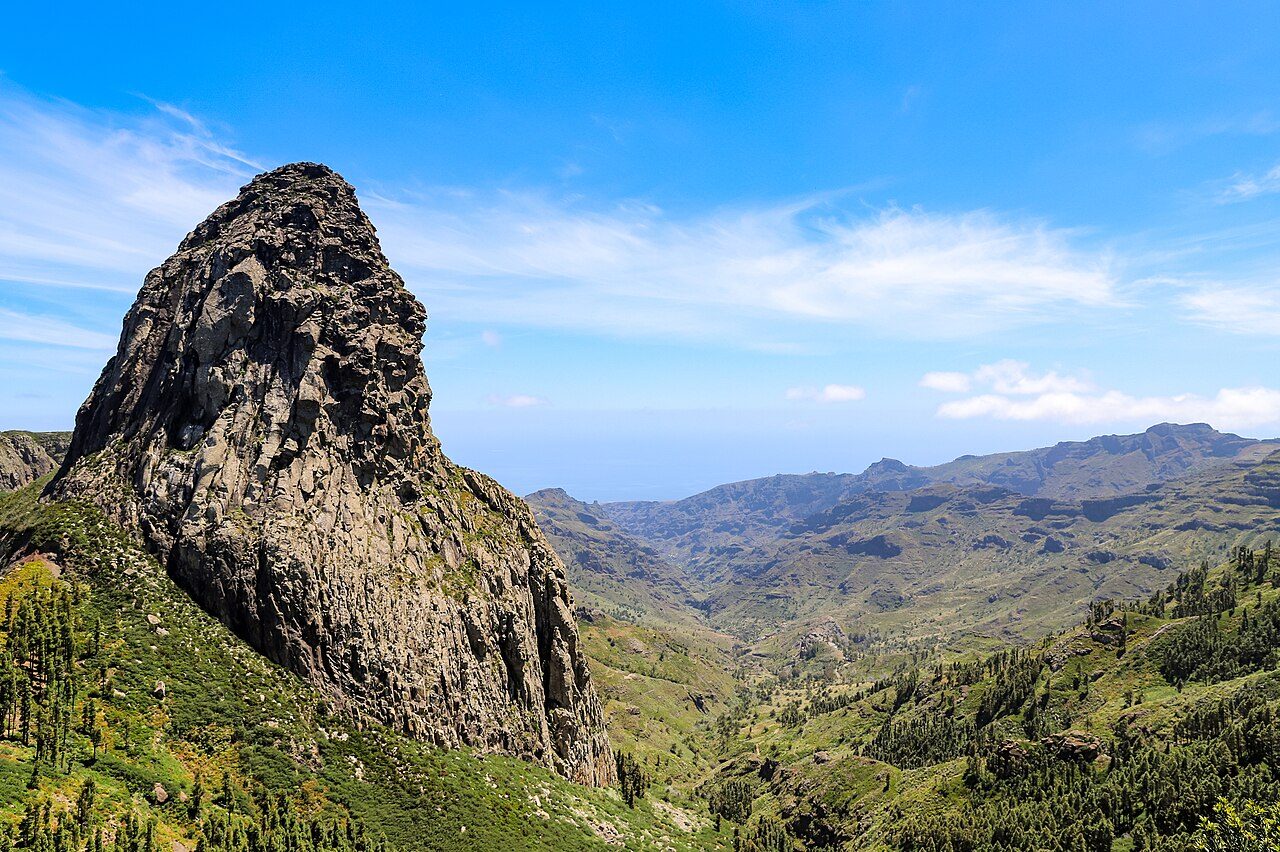
Photo: dronepicr via Wikimedia Commons, CC BY 2.0. Cropped and resized for display.
Park facts
| Park type | National Park |
|---|---|
| Location | Spain |
| Area | 9,154 acres (3,705 ha) |
| Established | 1981 |
| Highest point | Alto de Garajonay — 1,487 m (4,879 ft) |
| Coordinates | 28.1262° N, 17.2372° W |
Every fact above is taken from the sources listed below; anything no source states is left blank rather than guessed.
About Garajonay National Park
Garajonay National Park (Spanish: Parque nacional de Garajonay, pronounced [ˈpaɾke naθjoˈnal de ɣaɾaxoˈnaj]) is located in the center and north of the island of La Gomera, one of the Canary Islands (Spain). It was declared a national park in 1981 and a World Heritage Site by UNESCO in 1986. It occupies 40 km2 (15 sq mi) and it extends into each of the six municipalities on the island. Nearly 450,000 tourists visit the park every year. There is accommodation for tourists just outside the park's boundary. The park is named after the rock formation of Garajonay, the highest point on the island at 1,487 metres (4,879 ft).
Description from the park's Wikipedia article (CC BY-SA), linked in the sources below.
Planning your visit
What to do
Airports near this park
The airports a visitor would actually fly into, nearest first — each link opens its profile on our sister site AirportProfiles.
- Tenerife Sur Airport (TFS) · Tenerife, Spain · 40.9 miles away
- Tenerife Norte-Ciudad de La Laguna Airport (TFN) · Tenerife, Spain · 59.8 miles away
- Gran Canaria Airport (LPA) · Gran Canaria Island, Spain · 113.7 miles away
Parks nearby
More parks in Spain

Frequently asked questions
Where is Garajonay National Park?
Garajonay National Park is in Spain (28.1262° N, 17.2372° W).
When was Garajonay National Park established?
Garajonay National Park was established in 1981, per the source listed at the foot of this page.
How big is Garajonay National Park?
Garajonay National Park covers 9,154 acres (3,705 ha).
What is the highest point in Garajonay National Park?
The highest point is Alto de Garajonay, at 1,487 metres (4,879 ft).
Sources
- https://www.wikidata.org/wiki/Q464942 — Wikidata (CC0) — name, country, coordinates, area, established year, highest point where stated.
- https://en.wikipedia.org/wiki/Garajonay_National_Park — Wikipedia article — description (CC BY-SA).