
State Park · Massachusetts, United States
Maudslay State Park
Maudslay State Park is a state park in Massachusetts, United States, covering 483 acres (195 ha), established in 1985.
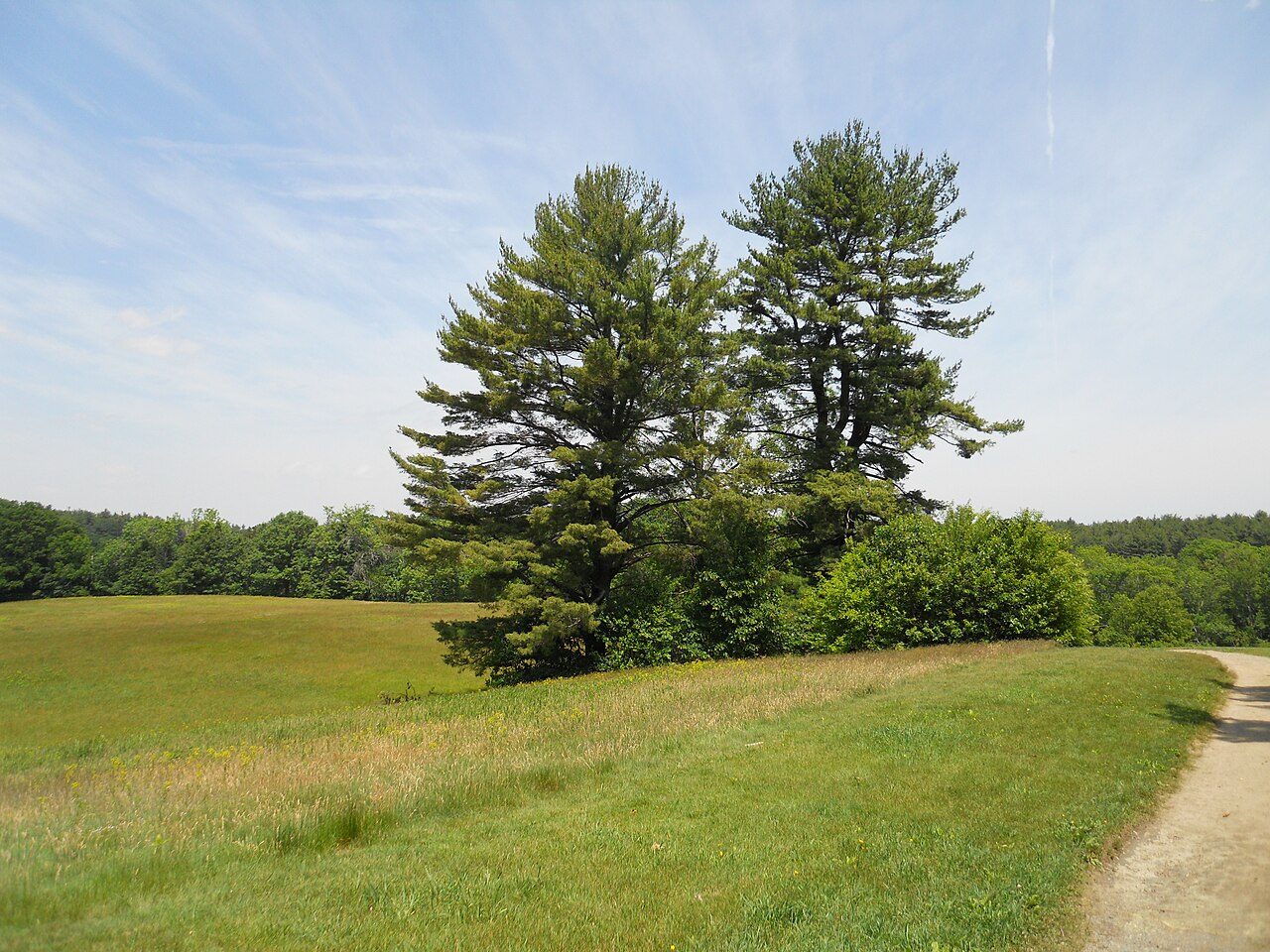
Photo: Botteville via Wikimedia Commons, Public domain. Cropped and resized for display.
Park facts
| Park type | State Park |
|---|---|
| Location | Essex, Massachusetts, United States |
| Area | 483 acres (195 ha) |
| Established | 1985 |
| Coordinates | 42.8211° N, 70.9247° W |
| Managed by | Massachusetts state park system |
Every fact above is taken from the sources listed below; anything no source states is left blank rather than guessed.
About Maudslay State Park
Maudslay State Park is a landscaped and decorative public recreation area located along the right bank of the Merrimack River in Newburyport, Massachusetts, in the United States. The park is bordered on the west side by the Artichoke River, which is also the border between Newburyport and West Newbury. It features thickets and gardens, rolling meadows, tall pines, and one of the largest naturally occurring stands of mountain laurel in the Commonwealth. Within the park, visitors can find numerous ornamental trees, such as azaleas, and rhododendrons. The park is managed by the Department of Conservation and Recreation.
Description from the park's Wikipedia article (CC BY-SA), linked in the sources below.
Airports near this park
The airports a visitor would actually fly into, nearest first — each link opens its profile on our sister site AirportProfiles.
- Boston Logan International Airport (BOS) · Boston, United States · 32.0 miles away
- Portland International Jetport (PWM) · Portland, United States · 64.9 miles away
- Rhode Island T. F. Green International Airport (PVD) · Providence/Warwick, United States · 79.9 miles away
Parks nearby
More parks in Massachusetts

Frequently asked questions
Where is Maudslay State Park?
Maudslay State Park is in Massachusetts, United States (42.8211° N, 70.9247° W).
When was Maudslay State Park established?
Maudslay State Park was established in 1985, per the source listed at the foot of this page.
How big is Maudslay State Park?
Maudslay State Park covers 483 acres (195 ha).
Sources
- https://en.wikipedia.org/wiki/List_of_Massachusetts_state_parks — Wikipedia list of Massachusetts state parks — park name, county/location, size, year where the table states them.
- https://en.wikipedia.org/wiki/Maudslay_State_Park — Wikipedia article — description (CC BY-SA).