
National Park · Kenya
Mount Longonot National Park
Mount Longonot National Park is a national park in Kenya.
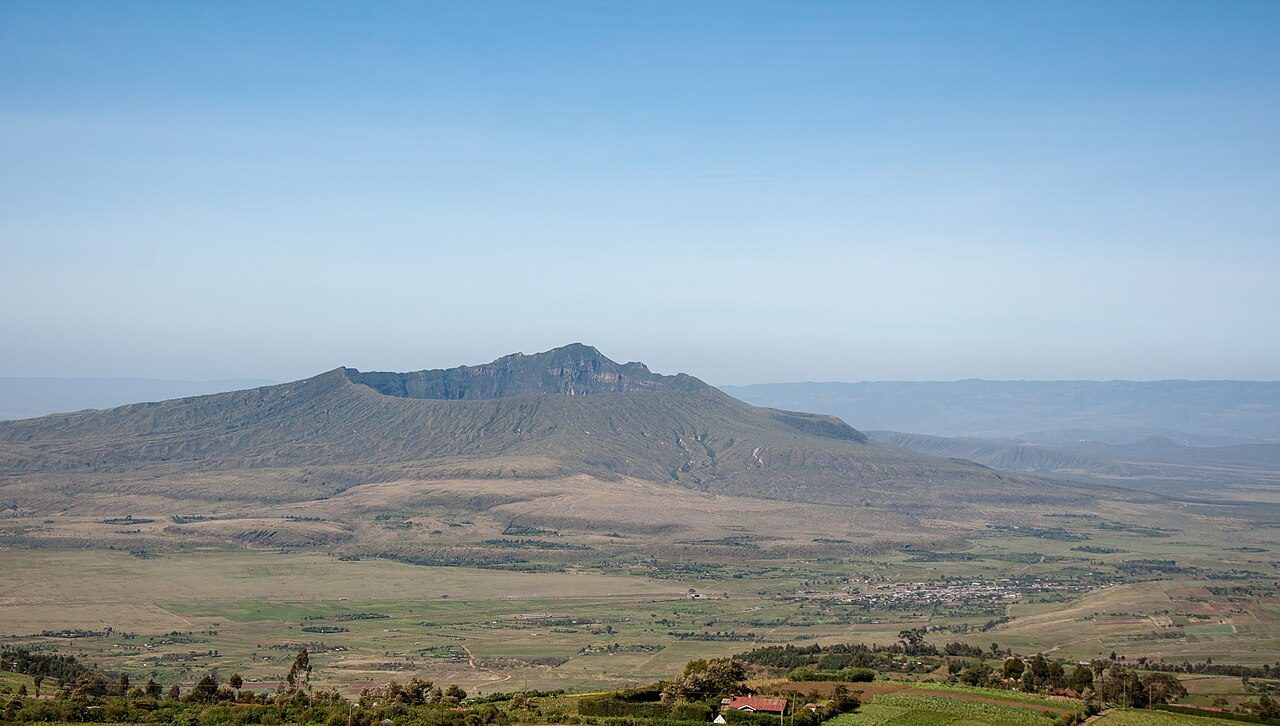
Photo: Hansueli Krapf This file was uploaded with Commonist . via Wikimedia Commons, CC BY-SA 4.0. Cropped and resized for display.
Park facts
| Park type | National Park |
|---|---|
| Location | Kenya |
| Coordinates | 0.9153° S, 36.4569° E |
Every fact above is taken from the sources listed below; anything no source states is left blank rather than guessed.
About Mount Longonot National Park
Mount Longonot is a stratovolcano located southeast of Lake Naivasha in the Great Rift Valley of Kenya, Africa. It is thought to have last erupted in the 1860s. Its name is derived from the Maasai word Olongongot, meaning "mountains of many spurs" or "steep ridges". Mount Longonot is protected by the Kenya Wildlife Service as part of Mount Longonot National Park. A 3.1 km (1.9 mi) 3.1-km (1.9-mile) trail runs from the park entrance up to the crater rim, and continues in a 7.2-km (4.5-mile) loop encircling the crater.
Description from the park's Wikipedia article (CC BY-SA), linked in the sources below.
Airports near this park
The airports a visitor would actually fly into, nearest first — each link opens its profile on our sister site AirportProfiles.
- Jomo Kenyatta International Airport (NBO) · Nairobi, Kenya · 42.9 miles away
- Eldoret International Airport (EDL) · Eldoret, Kenya · 124.1 miles away
- Kisumu International Airport (KIS) · Kisumu, Kenya · 132.4 miles away
Parks nearby

More parks in Kenya

Frequently asked questions
Where is Mount Longonot National Park?
Mount Longonot National Park is in Kenya (0.9153° S, 36.4569° E).
Sources
- https://www.wikidata.org/wiki/Q3845176 — Wikidata (CC0) — name, country, coordinates, area, established year, highest point where stated.
- https://en.wikipedia.org/wiki/Mount_Longonot_National_Park — Wikipedia article — description (CC BY-SA).