
National Park · Botswana
Nxai Pan National Park
Nxai Pan National Park is a national park in Botswana, established in 1992.
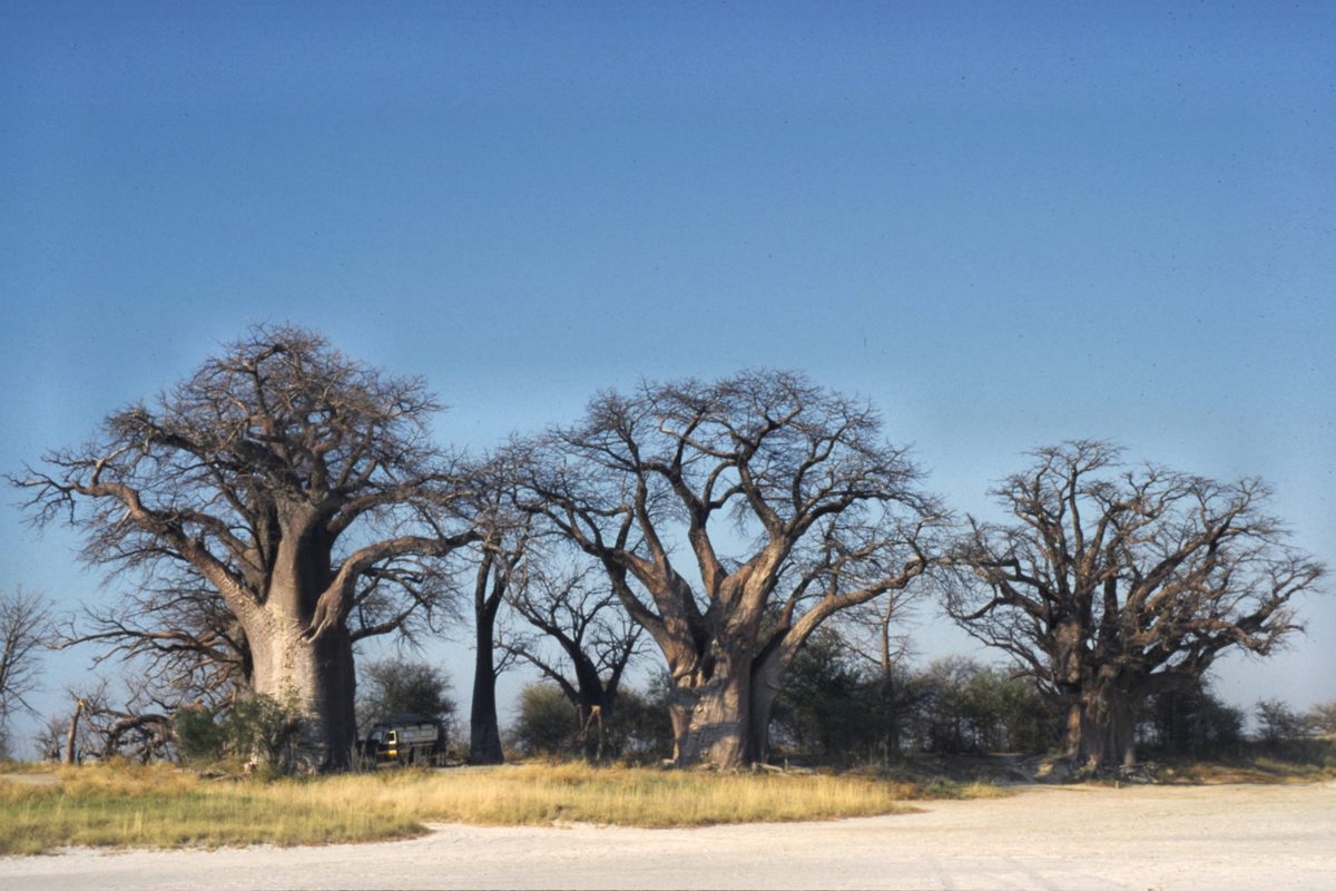
Photo: Ralf Ellerich via Wikimedia Commons, CC BY-SA 3.0. Cropped and resized for display.
Park facts
| Park type | National Park |
|---|---|
| Location | Botswana |
| Established | 1992 |
| Coordinates | 20.0417° S, 24.7689° E |
Every fact above is taken from the sources listed below; anything no source states is left blank rather than guessed.
About Nxai Pan National Park
Nxai Pan National Park is a national park in north-eastern Botswana, consisting of Nxai Pan, which is one of the Makgadikgadi Pan salt flats. Nxai Pan National Park lies just north of the Maun-Nata main road and adjoins Makgadikgadi Pans National Park on its northern border. The pan itself is a fossil lake bed of approximately 40 km2 in size. It is home to the cluster of millennia-old baobab trees, which owe their name to Thomas Baines, who first described them for Western botany. Baines’ Baobabs, as they are known today, are a sight sought by many travelers venturing into this untamed terrain of Botswana.
Description from the park's Wikipedia article (CC BY-SA), linked in the sources below.
Airports near this park
The airports a visitor would actually fly into, nearest first — each link opens its profile on our sister site AirportProfiles.
- Maun International Airport (MUB) · Maun, Botswana · 87.0 miles away
Parks nearby

More parks in Botswana
Frequently asked questions
Where is Nxai Pan National Park?
Nxai Pan National Park is in Botswana (20.0417° S, 24.7689° E).
When was Nxai Pan National Park established?
Nxai Pan National Park was established in 1992, per the source listed at the foot of this page.
Sources
- https://www.wikidata.org/wiki/Q859377 — Wikidata (CC0) — name, country, coordinates, area, established year, highest point where stated.
- https://en.wikipedia.org/wiki/Nxai_Pan_National_Park — Wikipedia article — description (CC BY-SA).