
National Park · Zimbabwe
Nyanga National Park
Nyanga National Park is a national park in Zimbabwe, established in 1950.
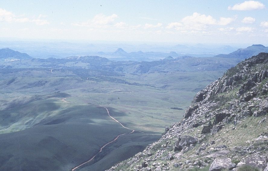
Photo: Babakathy via Wikimedia Commons, Public domain. Cropped and resized for display.
Park facts
| Park type | National Park |
|---|---|
| Location | Zimbabwe |
| Established | 1950 |
| Coordinates | 18.2167° S, 32.7500° E |
Every fact above is taken from the sources listed below; anything no source states is left blank rather than guessed.
About Nyanga National Park
Nyanga National Park lies in the north of Zimbabwe's Eastern Highlands. One of the first national parks to be declared in the country, it contains the highest land in Zimbabwe, with green hills and perennial rivers. Most of its terrain consists of rolling downland, sometimes lightly wooded, lying at altitudes between 1,800–2,593 metres (6,560–7,544 feet). Mount Nyangani, the highest point in Zimbabwe, lies in the centre of the park and Mutarazi Falls, Zimbabwe's highest waterfall, is in the south of the park. Nyanga National Park incorporates the former Mutarazi Falls National Park on its southern boundary.
Description from the park's Wikipedia article (CC BY-SA), linked in the sources below.
Airports near this park
The airports a visitor would actually fly into, nearest first — each link opens its profile on our sister site AirportProfiles.
- Robert Gabriel Mugabe International Airport (HRE) · Harare, Zimbabwe · 110.6 miles away
Parks nearby
More parks in Zimbabwe

Frequently asked questions
Where is Nyanga National Park?
Nyanga National Park is in Zimbabwe (18.2167° S, 32.7500° E).
When was Nyanga National Park established?
Nyanga National Park was established in 1950, per the source listed at the foot of this page.
Sources
- https://www.wikidata.org/wiki/Q478677 — Wikidata (CC0) — name, country, coordinates, area, established year, highest point where stated.
- https://en.wikipedia.org/wiki/Nyanga_National_Park — Wikipedia article — description (CC BY-SA).