
National Park · Bulgaria
Pirin National Park
Pirin National Park is a national park in Bulgaria, covering 94,765 acres (38,350 ha), established in 1962.
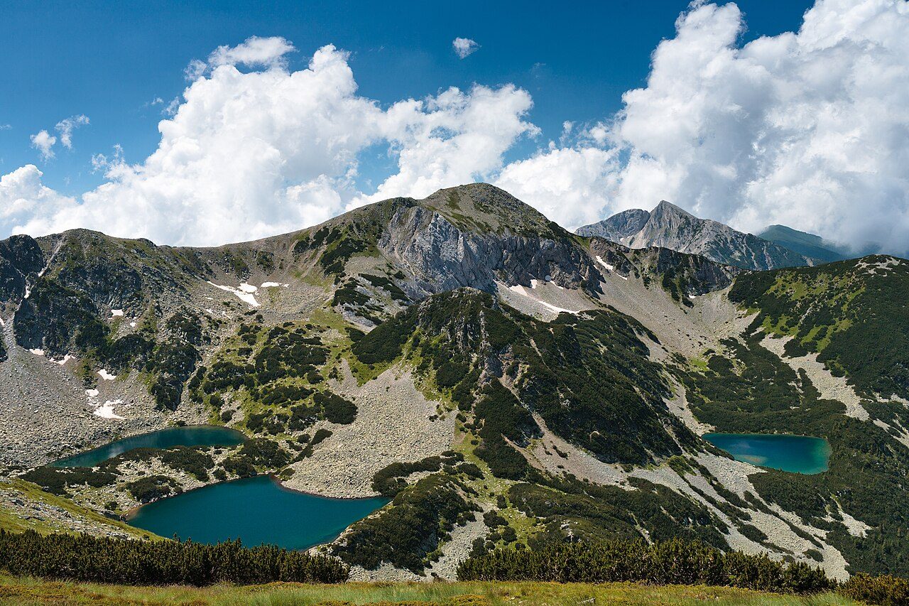
Photo: Dido3 via Wikimedia Commons, CC BY-SA 4.0. Cropped and resized for display.
Park facts
| Park type | National Park |
|---|---|
| Location | Bulgaria |
| Area | 94,765 acres (38,350 ha) |
| Established | 1962 |
| Highest point | Vihren — 2,914 m (9,561 ft) |
| Coordinates | 41.6722° N, 23.4878° E |
Every fact above is taken from the sources listed below; anything no source states is left blank rather than guessed.
About Pirin National Park
Pirin National Park (Bulgarian: Национален парк "Пирин"), originally named Vihren National Park, covering the larger part of the Pirin Mountains in southwestern Bulgaria, spanning an area of 403.56 square kilometers (155.82 mi2). It is one of the three national parks in the country, the others being Rila National Park and Central Balkan National Park. The park was established in 1962 and its territory was expanded several times since then. Pirin National Park was declared a UNESCO World Heritage Site in 1983.
Description from the park's Wikipedia article (CC BY-SA), linked in the sources below.
Airports near this park
The airports a visitor would actually fly into, nearest first — each link opens its profile on our sister site AirportProfiles.
- Sofia Airport (SOF) · Sofia, Bulgaria · 70.9 miles away
- Plovdiv International Airport (PDV) · Plovdiv, Bulgaria · 75.3 miles away
- Kavala Alexander the Great International Airport (KVA) · Kavala, Greece · 78.7 miles away
Parks nearby

More parks in Bulgaria
Frequently asked questions
Where is Pirin National Park?
Pirin National Park is in Bulgaria (41.6722° N, 23.4878° E).
When was Pirin National Park established?
Pirin National Park was established in 1962, per the source listed at the foot of this page.
How big is Pirin National Park?
Pirin National Park covers 94,765 acres (38,350 ha).
What is the highest point in Pirin National Park?
The highest point is Vihren, at 2,914 metres (9,561 ft).
Sources
- https://www.wikidata.org/wiki/Q651314 — Wikidata (CC0) — name, country, coordinates, area, established year, highest point where stated.
- https://en.wikipedia.org/wiki/Pirin_National_Park — Wikipedia article — description (CC BY-SA).