
National Park · California, United States
Sequoia National Park
Sequoia National Park is a national park in California, United States, covering 404,063 acres (163,518 ha), established in 1890; it recorded 1,378,337 visits in 2025.
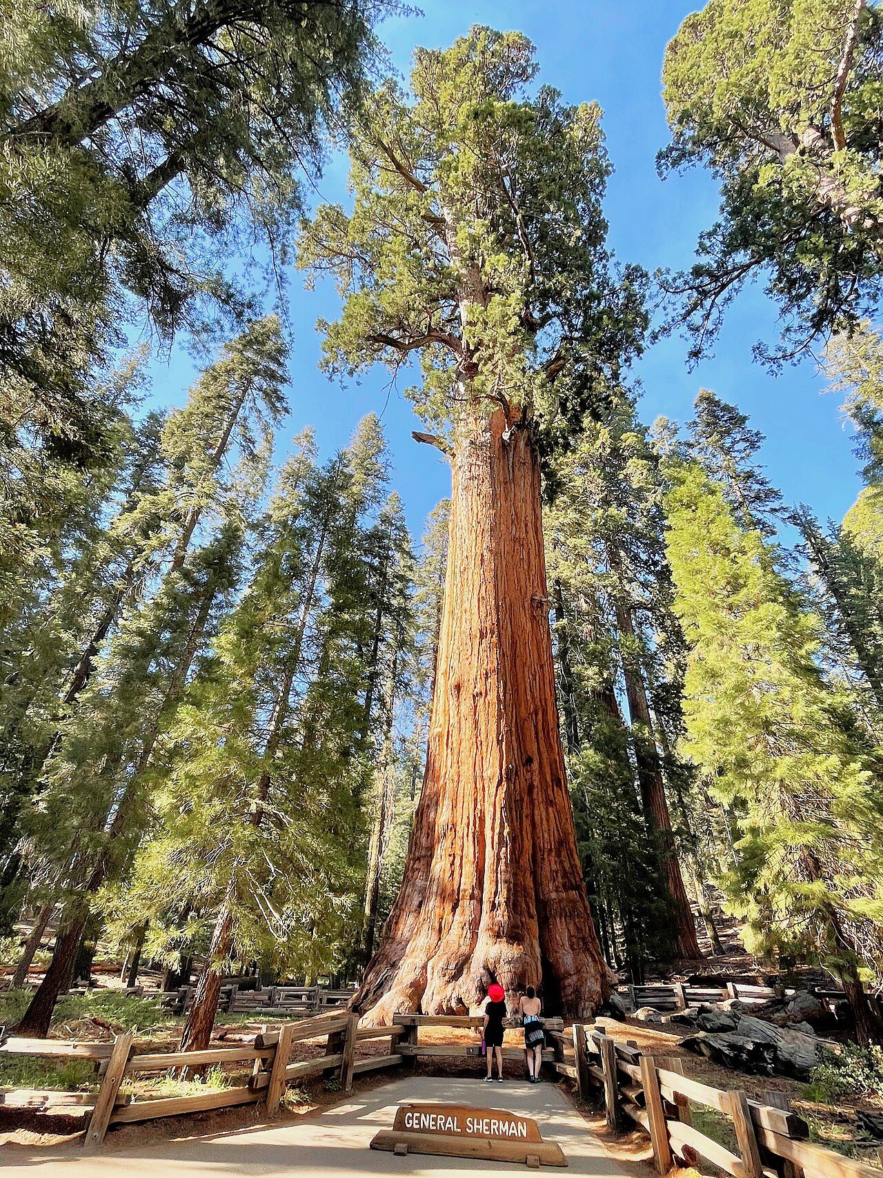
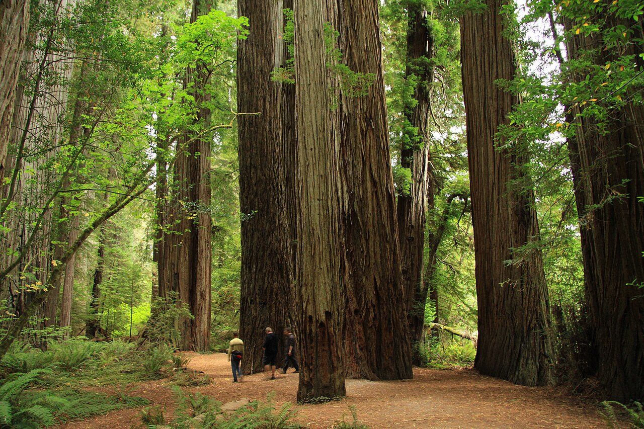
Photo: Marty Aligata via Wikimedia Commons, CC BY-SA 4.0. Cropped and resized for display.
Park facts
| Park type | National Park |
|---|---|
| Location | California, United States |
| Area | 404,063 acres (163,518 ha) |
| Established | 1890 |
| Annual visits (2025) | 1,378,337 |
| Highest point | Mount Whitney — 4,421 m (14,505 ft) |
| Coordinates | 36.4300° N, 118.6800° W |
| Managed by | National Park Service |
Every fact above is taken from the sources listed below; anything no source states is left blank rather than guessed.
About Sequoia National Park
Sequoia National Park is a national park of the United States in the southern Sierra Nevada east of Visalia, California. The park was established on September 25, 1890, and today protects 404,064 acres (631 sq mi; 163,519 ha; 1,635 km2) of forested mountainous terrain. Encompassing a vertical relief of nearly 13,000 feet (4,000 m), the park contains the highest point in the contiguous United States, Mount Whitney, at 14,505 feet (4,421 m) above sea level.
Description from the park's Wikipedia article (CC BY-SA), linked in the sources below.
Planning your visit
Best time to visit
June to September — warm days and open roads; winters bring snow
What to do
Getting there
| Nearest town | Three Rivers, California |
|---|---|
| Nearest airport | Fresno Yosemite International Airport |
Where to stay
| Campgrounds | Yes |
|---|---|
| Lodges | Wuksachi Lodge inside the park |
Famous trails
- Congress Trail — 2.0 miles (3.2 km) — Easy
- Moro Rock Trail — 0.4 miles (0.6 km) — Moderate
Like Sequoia National Park? Visit Sequoia National Park’s official park page for hours and current conditions before you travel.
Airports near this park
The airports a visitor would actually fly into, nearest first — each link opens its profile on our sister site AirportProfiles.
- Fresno Yosemite International Airport (FAT) · Fresno, United States · 62.3 miles away
Parks nearby
More parks in California

Frequently asked questions
Where is Sequoia National Park?
Sequoia National Park is in California, United States (36.4300° N, 118.6800° W).
When was Sequoia National Park established?
Sequoia National Park was established in 1890, per the source listed at the foot of this page.
How big is Sequoia National Park?
Sequoia National Park covers 404,063 acres (163,518 ha).
How many people visit Sequoia National Park each year?
It recorded 1,378,337 recreation visits in 2025, the latest published figure.
What is the highest point in Sequoia National Park?
The highest point is Mount Whitney, at 4,421 metres (14,505 ft).
When is the best time to visit Sequoia National Park?
June to September — warm days and open roads; winters bring snow.
Does Sequoia National Park have campgrounds?
Yes — Sequoia National Park has campgrounds.
How do I get to Sequoia National Park?
The nearest town is Three Rivers, California. The nearest airport is Fresno Yosemite International Airport.
Sources
- https://en.wikipedia.org/wiki/List_of_the_United_States_National_Park_System_official_units — Wikipedia list of National Park System official units — unit name, state, official designation.
- https://en.wikipedia.org/wiki/List_of_areas_in_the_United_States_National_Park_System — Wikipedia list of National Park System areas — year established and gross area.
- https://en.wikipedia.org/wiki/List_of_national_parks_of_the_United_States — Wikipedia list of US national parks — coordinates, established date, area, recreation visitors (2025), description.
- https://en.wikipedia.org/wiki/Sequoia_National_Park — Wikipedia article — description (CC BY-SA).
- https://www.nps.gov/seki/ — Official park page.
- https://www.nps.gov/seki/planyourvisit/hiking.htm — Named trails, as stated by the source.