
National Park · Guatemala
Tikal National Park
Tikal National Park is a national park in Guatemala, covering 142,332 acres (57,600 ha).
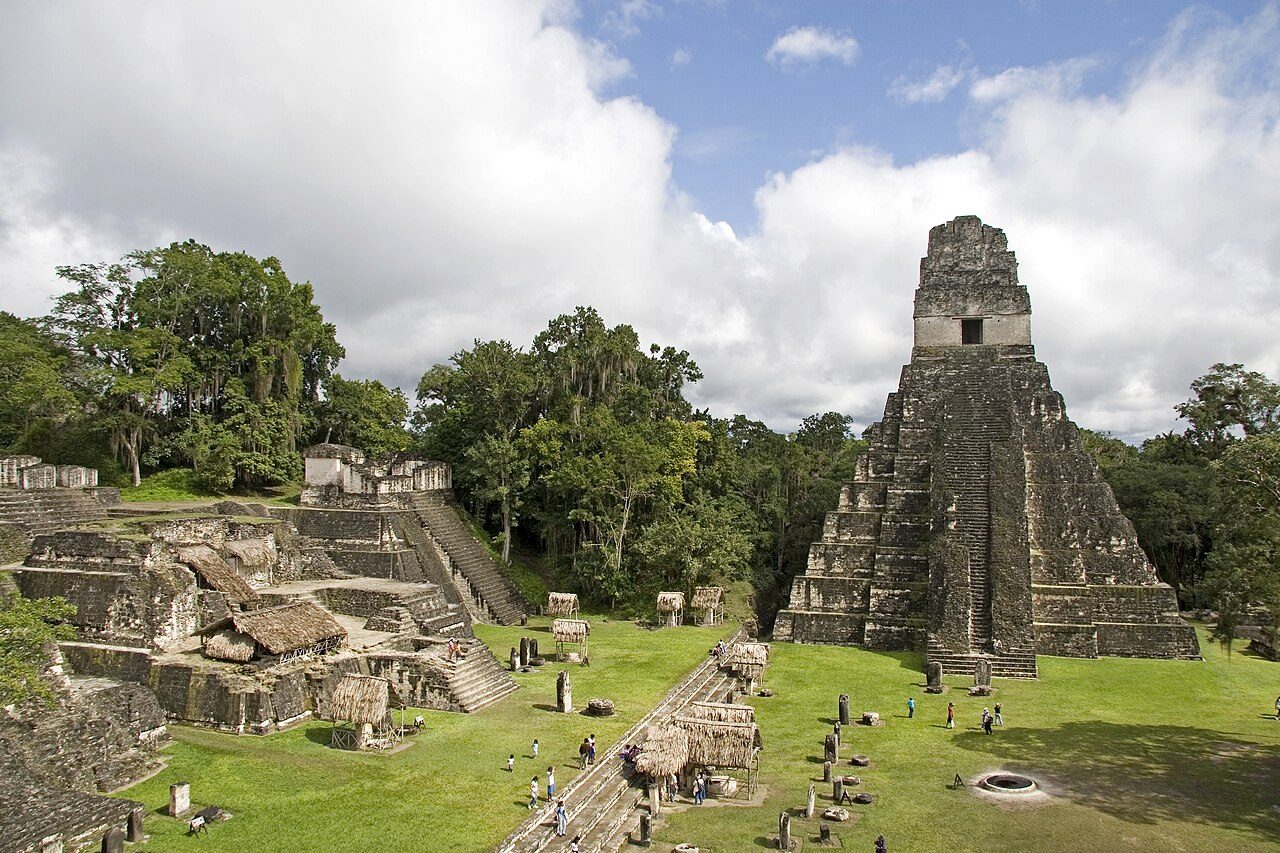
Photo: Mundo Maya via Wikimedia Commons, CC BY-SA 4.0. Cropped and resized for display.

Park facts
| Park type | National Park |
|---|---|
| Location | Guatemala |
| Area | 142,332 acres (57,600 ha) |
| Coordinates | 17.2167° N, 89.6167° W |
Every fact above is taken from the sources listed below; anything no source states is left blank rather than guessed.
About Tikal National Park
Tikal (; Tik'al in modern Mayan orthography) is the ruin of an ancient city, which was likely to have been called Yax Mutal, found in a rainforest in Guatemala. One of the largest archaeological sites and urban centers of the pre-Columbian Maya civilization, it is located in the archaeological region of the Petén Basin in what is now the Petén Department in northern Guatemala. The site is part of Guatemala's Tikal National Park, which was declared a UNESCO World Heritage Site in 1979. Tikal was the capital of a state that became one of the most powerful kingdoms of the ancient Maya.
Description from the park's Wikipedia article (CC BY-SA), linked in the sources below.
Airports near this park
The airports a visitor would actually fly into, nearest first — each link opens its profile on our sister site AirportProfiles.
- Philip S. W. Goldson International Airport (BZE) · Belize City, Belize · 89.4 miles away
Parks nearby
Elijio Panti National Park
Maya Biosphere Reserve
Guanacaste National Park
Chiquibul National Park
Five Blues Lake National Park
Billy Barquedier National Park
More parks in Guatemala
Frequently asked questions
Where is Tikal National Park?
Tikal National Park is in Guatemala (17.2167° N, 89.6167° W).
How big is Tikal National Park?
Tikal National Park covers 142,332 acres (57,600 ha).
Sources
- https://www.wikidata.org/wiki/Q6063031 — Wikidata (CC0) — name, country, coordinates, area, established year, highest point where stated.
- https://en.wikipedia.org/wiki/Tikal_National_Park — Wikipedia article — description (CC BY-SA).