
State Park · Massachusetts, United States
Wachusett Reservoir
Wachusett Reservoir is a state park in Massachusetts, United States, covering 4,135 acres (1,673 ha).
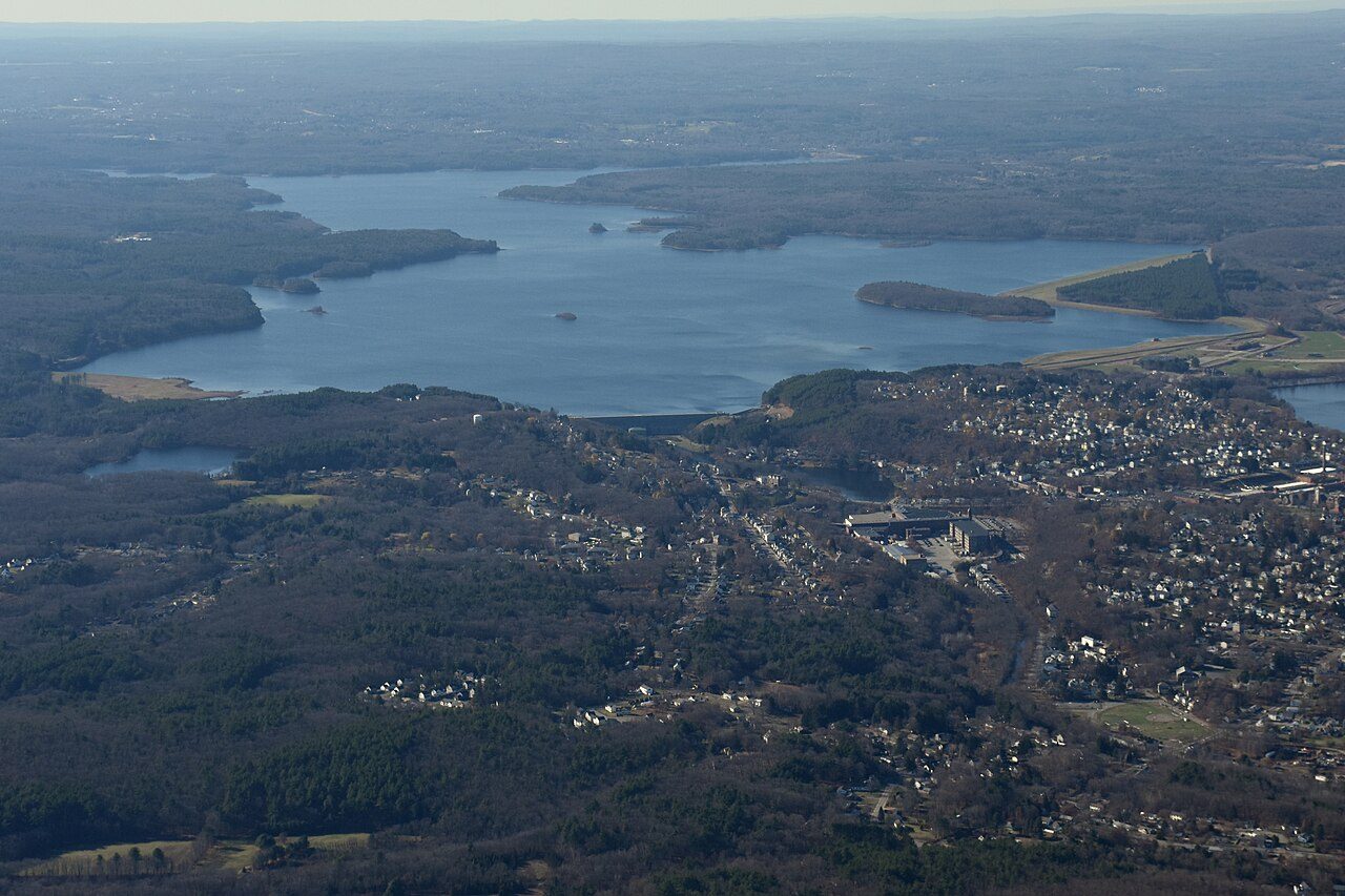
Photo: Nick Allen via Wikimedia Commons, CC BY-SA 4.0. Cropped and resized for display.
Park facts
| Park type | State Park |
|---|---|
| Location | Worcester, Massachusetts, United States |
| Area | 4,135 acres (1,673 ha) |
| Coordinates | 42.3694° N, 71.7383° W |
| Managed by | Massachusetts state park system |
Every fact above is taken from the sources listed below; anything no source states is left blank rather than guessed.
About Wachusett Reservoir
The Wachusett Reservoir is the second largest body of water in the state of Massachusetts. It is located in central Massachusetts, northeast of Worcester. It is part of the water supply system for metropolitan Boston maintained by the Massachusetts Water Resources Authority (MWRA). It has an aggregate capacity of 65 billion US gallons (250,000,000 m3) and an area of almost 7 square miles (18 km2). Water from the reservoir flows to the covered Norumbega Storage Facility via the Cosgrove Tunnel and the MetroWest Water Supply Tunnel. The reservoir has a maximum depth of 120 feet (37 m) and a mean depth of 48 feet (15 m).
Description from the park's Wikipedia article (CC BY-SA), linked in the sources below.
Airports near this park
The airports a visitor would actually fly into, nearest first — each link opens its profile on our sister site AirportProfiles.
- Boston Logan International Airport (BOS) · Boston, United States · 37.3 miles away
- Rhode Island T. F. Green International Airport (PVD) · Providence/Warwick, United States · 47.3 miles away
- Bradley International Airport (BDL) · Hartford, United States · 57.0 miles away
Parks nearby
More parks in Massachusetts

Frequently asked questions
Where is Wachusett Reservoir?
Wachusett Reservoir is in Massachusetts, United States (42.3694° N, 71.7383° W).
How big is Wachusett Reservoir?
Wachusett Reservoir covers 4,135 acres (1,673 ha).
Sources
- https://en.wikipedia.org/wiki/List_of_Massachusetts_state_parks — Wikipedia list of Massachusetts state parks — park name, county/location, size, year where the table states them.
- https://en.wikipedia.org/wiki/Wachusett_Reservoir — Wikipedia article — description (CC BY-SA).