
State Trail · Oregon, United States
Banks–Vernonia State Trail
Banks–Vernonia State Trail is a state trail in Oregon, United States.
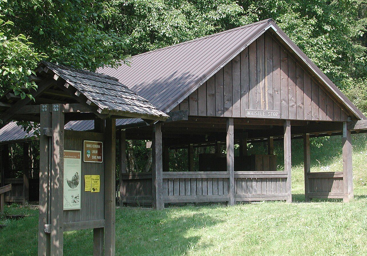
Photo: Finetooth via Wikimedia Commons, CC BY-SA 3.0. Cropped and resized for display.
Park facts
| Park type | State Trail |
|---|---|
| Location | Portland/Columbia River Gorge, Oregon, United States |
| Coordinates | 45.6651° N, 123.1634° W |
| Managed by | Oregon state park system |
Every fact above is taken from the sources listed below; anything no source states is left blank rather than guessed.
About Banks–Vernonia State Trail
The Banks–Vernonia State Trail is a paved rail trail and state park in northwest Oregon in the United States. It runs for 21 miles (34 km), primarily north–south, between the towns of Vernonia in Columbia County and Banks in Washington County on an abandoned railroad bed. Banks is about 25 miles (40 km) west of Portland. The 8-foot-wide (2.4 m) trail is open to non-motorized uses such as hiking and biking. A 4-foot-wide (1.2 m) horse trail parallels the hiking and biking trail. The rail trail crosses 12 bridges and the Buxton Trestle, a former railroad trestle bridge that is 600 feet (180 m) long and 80 feet (24 m) high.
Description from the park's Wikipedia article (CC BY-SA), linked in the sources below.
Planning your visit
What to do
Getting there
| Nearest town | Portland, Oregon |
|---|---|
| Getting there | about 25 miles west of Portland |
Airports near this park
The airports a visitor would actually fly into, nearest first — each link opens its profile on our sister site AirportProfiles.
- Portland International Airport (PDX) · Portland, United States · 27.8 miles away
- Seattle–Tacoma International Airport (SEA) · Seattle, United States · 129.7 miles away
Parks nearby
More parks in Oregon

Frequently asked questions
Where is Banks–Vernonia State Trail?
Banks–Vernonia State Trail is in Oregon, United States (45.6651° N, 123.1634° W).
How do I get to Banks–Vernonia State Trail?
The nearest town is Portland, Oregon. about 25 miles west of Portland.
Sources
- https://en.wikipedia.org/wiki/List_of_Oregon_state_parks — Wikipedia list of Oregon state parks — park name, county/location, size, year where the table states them.
- https://en.wikipedia.org/wiki/Banks–Vernonia_State_Trail — Wikipedia article — description (CC BY-SA).