
National Park · Australia
Bellthorpe National Park
Bellthorpe National Park is a national park in Australia, covering 18,887 acres (7,643 ha), established in 2010.
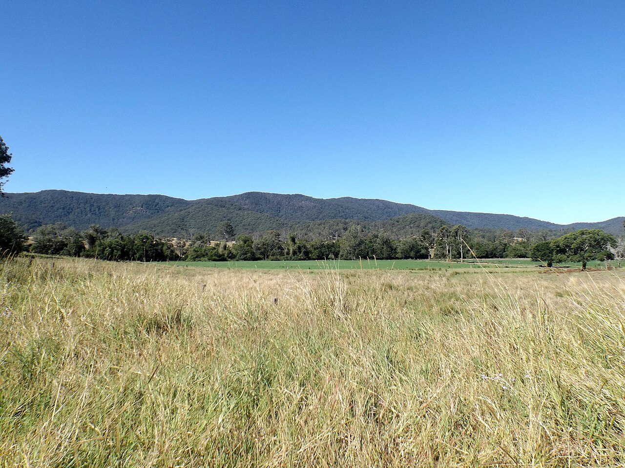
Photo: Shiftchange via Wikimedia Commons, CC0. Cropped and resized for display.
Park facts
| Park type | National Park |
|---|---|
| Location | Australia |
| Area | 18,887 acres (7,643 ha) |
| Established | 2010 |
| Coordinates | 26.8918° S, 152.6791° E |
Every fact above is taken from the sources listed below; anything no source states is left blank rather than guessed.
About Bellthorpe National Park
Bellthorpe National Park is a national park located in Bellthorpe, Booroobin and Sandy Creek in both the City of Moreton Bay and Somerset Region of South East Queensland, Australia. The park preserves eucalypt forest and rainforest of the southern Conondale Range. Parts of the national park were previously known as Bellthor. The rugged landscape at Bellthorpe falls within the catchment of Stony Creek, a tributary of the Stanley River. Along the waterway are several small waterfalls, cascades and a rock pool. The park also protects lands within the Brisbane River valley and Mary River catchments.
Description from the park's Wikipedia article (CC BY-SA), linked in the sources below.
Planning your visit
What to do
Airports near this park
The airports a visitor would actually fly into, nearest first — each link opens its profile on our sister site AirportProfiles.
- Sunshine Coast Airport (MCY) · Maroochydore, Australia · 32.4 miles away
- Brisbane International Airport (BNE) · Brisbane, Australia · 43.4 miles away
- Toowoomba Wellcamp Airport (WTB) · Toowoomba, Australia · 71.3 miles away
Parks nearby
More parks in Australia

Frequently asked questions
Where is Bellthorpe National Park?
Bellthorpe National Park is in Australia (26.8918° S, 152.6791° E).
When was Bellthorpe National Park established?
Bellthorpe National Park was established in 2010, per the source listed at the foot of this page.
How big is Bellthorpe National Park?
Bellthorpe National Park covers 18,887 acres (7,643 ha).
Sources
- https://www.wikidata.org/wiki/Q2660354 — Wikidata (CC0) — name, country, coordinates, area, established year, highest point where stated.
- https://en.wikipedia.org/wiki/Bellthorpe_National_Park — Wikipedia article — description (CC BY-SA).