
National Park · Canada
Cape Breton Highlands National Park
Cape Breton Highlands National Park is a national park in Canada, covering 234,256 acres (94,800 ha), established in 1936.
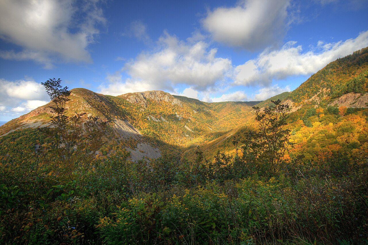
Photo: glangille via Wikimedia Commons, CC BY 2.0. Cropped and resized for display.
Park facts
| Park type | National Park |
|---|---|
| Location | Canada |
| Area | 234,256 acres (94,800 ha) |
| Established | 1936 |
| Highest point | White Hill — 535 m (1,755 ft) |
| Coordinates | 46.7167° N, 60.6597° W |
Every fact above is taken from the sources listed below; anything no source states is left blank rather than guessed.
About Cape Breton Highlands National Park
Cape Breton Highlands National Park is a Canadian national park on northern Cape Breton Island in Nova Scotia. The park was the first national park in the Atlantic provinces of Canada and covers an area of 948 square kilometres (366 mi2). It is one of 42 in Canada's system of national parks. It consists of mountains, valleys, waterfalls, rocky coastlines and the Cape Breton Highlands, a tundra-esque plateau. Forest types include Acadian and Boreal. The park includes the highest point in Nova Scotia, White Hill, at 533.5 m (1,750 ft) above sea level. Rivers in the park include the Chéticamp River and the North Aspy River.
Description from the park's Wikipedia article (CC BY-SA), linked in the sources below.
Like Cape Breton Highlands National Park? Visit Cape Breton Highlands National Park’s official park page for hours and current conditions before you travel.
Airports near this park
The airports a visitor would actually fly into, nearest first — each link opens its profile on our sister site AirportProfiles.
- Sydney / J.A. Douglas McCurdy Airport (YQY) · Sydney, Canada · 48.1 miles away
- Îles-de-la-Madeleine Airport (YGR) · Les Îles-de-la-Madeleine, Canada · 71.9 miles away
- Charlottetown Airport (YYG) · Charlottetown, Canada · 120.9 miles away
Parks nearby
More parks in Canada









Frequently asked questions
Where is Cape Breton Highlands National Park?
Cape Breton Highlands National Park is in Canada (46.7167° N, 60.6597° W).
When was Cape Breton Highlands National Park established?
Cape Breton Highlands National Park was established in 1936, per the source listed at the foot of this page.
How big is Cape Breton Highlands National Park?
Cape Breton Highlands National Park covers 234,256 acres (94,800 ha).
What is the highest point in Cape Breton Highlands National Park?
The highest point is White Hill, at 535 metres (1,755 ft).
Sources
- https://www.wikidata.org/wiki/Q253517 — Wikidata (CC0) — name, country, coordinates, area, established year, highest point where stated.
- https://en.wikipedia.org/wiki/Cape_Breton_Highlands_National_Park — Wikipedia article — description (CC BY-SA).