
Provincial Park · Canada
Restoule Provincial Park
Restoule Provincial Park is a provincial park in Canada, covering 6,472 acres (2,619 ha), established in 1963.
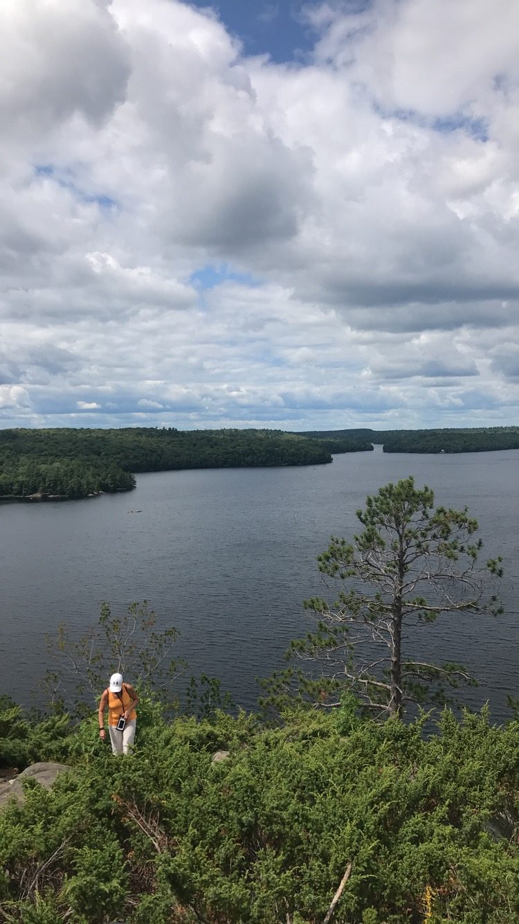
Photo: LivChxpman via Wikimedia Commons, CC BY-SA 4.0. Cropped and resized for display.
Park facts
| Park type | Provincial Park |
|---|---|
| Location | Canada |
| Area | 6,472 acres (2,619 ha) |
| Established | 1963 |
| Coordinates | 46.0672° N, 79.7733° W |
Every fact above is taken from the sources listed below; anything no source states is left blank rather than guessed.
About Restoule Provincial Park
Restoule Provincial Park is a provincial park in Parry Sound District in Central Ontario, Canada. It is located between Restoule Lake and Stormy Lake and extends along the banks of the Restoule River to its mouth at the French River (excluding the banks belonging to the Dokis First Nation) in geographic Patterson Township and geographic Hardy Township. The park is located at the western terminus of Highway 534 northwest of Restoule, Ontario. The park offers three hiking trails and is home to coyotes, wolves, bears, otters, pine martens, moose and one of Ontario's largest white-tailed deer herds.
Description from the park's Wikipedia article (CC BY-SA), linked in the sources below.
Planning your visit
What to do
Like Restoule Provincial Park? Visit Restoule Provincial Park’s official park page for hours and current conditions before you travel.
Airports near this park
The airports a visitor would actually fly into, nearest first — each link opens its profile on our sister site AirportProfiles.
- North Bay Jack Garland Airport (YYB) · North Bay, Canada · 26.5 miles away
- Sudbury Airport (YSB) · Sudbury, Canada · 62.3 miles away
- Muskoka Airport (YQA) · Gravenhurst, Canada · 78.7 miles away
Parks nearby
More parks in Canada









Frequently asked questions
Where is Restoule Provincial Park?
Restoule Provincial Park is in Canada (46.0672° N, 79.7733° W).
When was Restoule Provincial Park established?
Restoule Provincial Park was established in 1963, per the source listed at the foot of this page.
How big is Restoule Provincial Park?
Restoule Provincial Park covers 6,472 acres (2,619 ha).
Sources
- https://www.wikidata.org/wiki/Q7316260 — Wikidata (CC0) — name, country, coordinates, area, established year, highest point where stated.
- https://en.wikipedia.org/wiki/Restoule_Provincial_Park — Wikipedia article — description (CC BY-SA).