
National Park · Japan
Shiretoko National Park
Shiretoko National Park is a national park in Japan, covering 95,464 acres (38,633 ha), established in 1964.
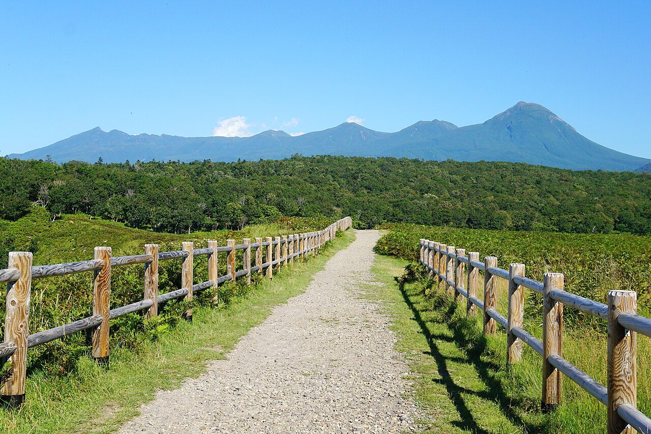
Photo: 663highland via Wikimedia Commons, CC BY 2.5. Cropped and resized for display.
Park facts
| Park type | National Park |
|---|---|
| Location | Japan |
| Area | 95,464 acres (38,633 ha) |
| Established | 1964 |
| Highest point | Mount Rausu — 1,660 m (5,446 ft) |
| Coordinates | 44.1619° N, 145.2356° E |
Every fact above is taken from the sources listed below; anything no source states is left blank rather than guessed.
About Shiretoko National Park
Shiretoko National Park (知床国立公園, Shiretoko Kokuritsu Kōen) covers most of the Shiretoko Peninsula at the northeastern tip of the island of Hokkaido, Japan. The word "Shiretoko" is derived from an Ainu word "sir etok", meaning "the place where the earth protrudes". One of the most remote regions in Japan, the peninsula is accessible only on foot or by boat. Shiretoko is best known as the home of Japan's largest population of brown bears, and for offering views of Kunashiri Island, ownership of which Japan and Russia dispute.
Description from the park's Wikipedia article (CC BY-SA), linked in the sources below.
Airports near this park
The airports a visitor would actually fly into, nearest first — each link opens its profile on our sister site AirportProfiles.
- Nakashibetsu Airport (SHB) · Nakashibetsu, Japan · 42.7 miles away
- Memanbetsu Airport (MMB) · Ōzora, Japan · 56.7 miles away
- Monbetsu Airport (MBE) · Monbetsu, Japan · 91.2 miles away
Parks nearby
More parks in Japan

Frequently asked questions
Where is Shiretoko National Park?
Shiretoko National Park is in Japan (44.1619° N, 145.2356° E).
When was Shiretoko National Park established?
Shiretoko National Park was established in 1964, per the source listed at the foot of this page.
How big is Shiretoko National Park?
Shiretoko National Park covers 95,464 acres (38,633 ha).
What is the highest point in Shiretoko National Park?
The highest point is Mount Rausu, at 1,660 metres (5,446 ft).
Sources
- https://www.wikidata.org/wiki/Q739391 — Wikidata (CC0) — name, country, coordinates, area, established year, highest point where stated.
- https://en.wikipedia.org/wiki/Shiretoko_National_Park — Wikipedia article — description (CC BY-SA).