
National Park · France
Calanques National Park
Calanques National Park is a national park in France, covering 128,489 acres (51,998 ha), established in 2012.
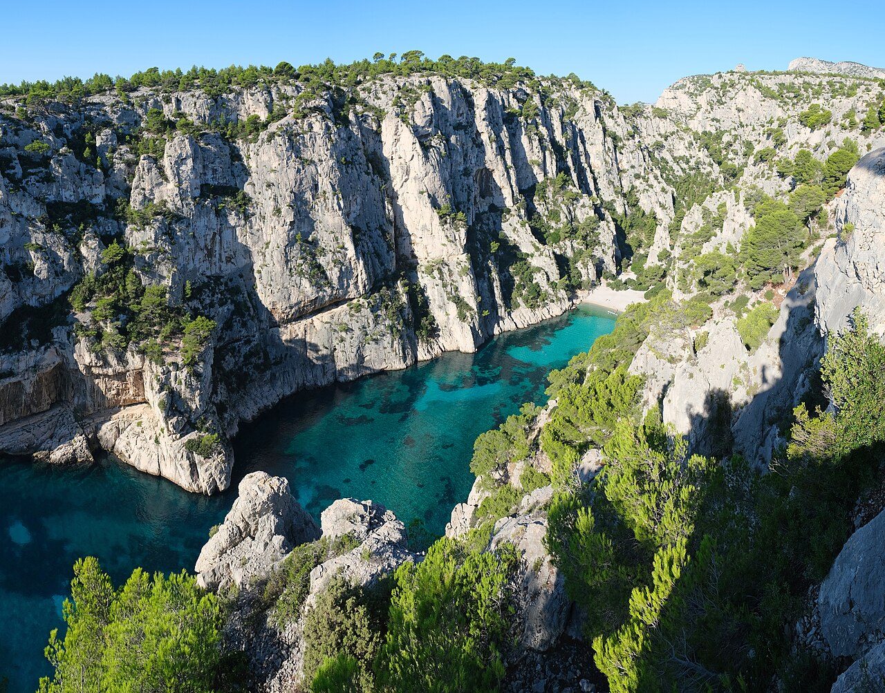
Photo: kallerna via Wikimedia Commons, CC BY-SA 4.0. Cropped and resized for display.
Park facts
| Park type | National Park |
|---|---|
| Location | France |
| Area | 128,489 acres (51,998 ha) |
| Established | 2012 |
| Highest point | Mont Carpiagne — 645 m (2,116 ft) |
| Coordinates | 43.2094° N, 5.4492° E |
Every fact above is taken from the sources listed below; anything no source states is left blank rather than guessed.
About Calanques National Park
Calanques National Park (French: Parc national des Calanques; Occitan: Parc Nacional dels Calanques) is a French national park located on the Mediterranean coast in Bouches-du-Rhône, Southern France, slightly west of the French Riviera. Established in 2012, it extends over 520 km2 (201 sq mi), of which 85 km2 (33 sq mi) is land, while the remaining is marine area. It includes parts of the Massif des Calanques stretching between Marseille's southern arrondissements, Cassis and La Ciotat. Some of the park's best known features include the calanques of Sormiou, Morgiou, Port-Miou, Sugiton, En-Vau, as well as the Cosquer Cave.
Description from the park's Wikipedia article (CC BY-SA), linked in the sources below.
Airports near this park
The airports a visitor would actually fly into, nearest first — each link opens its profile on our sister site AirportProfiles.
- Marseille Provence Airport (MRS) · Marignane, Bouches-du-Rhône, France · 19.8 miles away
- Montpellier-Méditerranée Airport (MPL) · Montpellier/Méditerranée, France · 78.8 miles away
- Nice-Côte d'Azur Airport (NCE) · Nice, Alpes-Maritimes, France · 93.9 miles away
Parks nearby
More parks in France

Frequently asked questions
Where is Calanques National Park?
Calanques National Park is in France (43.2094° N, 5.4492° E).
When was Calanques National Park established?
Calanques National Park was established in 2012, per the source listed at the foot of this page.
How big is Calanques National Park?
Calanques National Park covers 128,489 acres (51,998 ha).
What is the highest point in Calanques National Park?
The highest point is Mont Carpiagne, at 645 metres (2,116 ft).
Sources
- https://www.wikidata.org/wiki/Q2600427 — Wikidata (CC0) — name, country, coordinates, area, established year, highest point where stated.
- https://en.wikipedia.org/wiki/Calanques_National_Park — Wikipedia article — description (CC BY-SA).