
State Park · California, United States
Indian Grinding Rock State Historic Park
Indian Grinding Rock State Historic Park is a state park in California, United States.
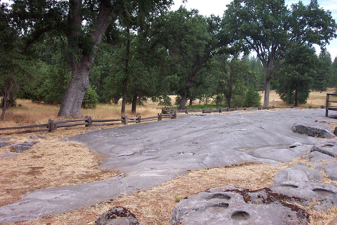
Photo: artq55 via Wikimedia Commons, CC BY-SA 2.0. Cropped and resized for display.
Park facts
| Park type | State Park |
|---|---|
| Location | Amador, California, United States |
| Coordinates | 38.4242° N, 120.8141° W |
| Managed by | California state park system |
Every fact above is taken from the sources listed below; anything no source states is left blank rather than guessed.
About Indian Grinding Rock State Historic Park
Indian Grinding Rock State Historic Park is a California State Park, preserving an outcropping of marbleized limestone with some 1,185 mortar holes—the largest collection of bedrock mortars in North America. It is located in the Sierra Nevada foothills, about 9 miles (14 km) northeast of Jackson. The park is nestled in a little valley 2,400 feet (732 m) above sea level, with open meadows and large specimens of valley oak that once provided the Miwok peoples of this area with an ample supply of acorns. The 135-acre (55 ha) park was established in 1962 and listed on the National Register of Historic Places in 1971.
Description from the park's Wikipedia article (CC BY-SA), linked in the sources below.
Planning your visit
Getting there
| Nearest town | Jackson, California |
|---|---|
| Getting there | about 9 miles northeast of Jackson |
Airports near this park
The airports a visitor would actually fly into, nearest first — each link opens its profile on our sister site AirportProfiles.
- Sacramento International Airport (SMF) · Sacramento, United States · 46.0 miles away
- Oakland San Francisco Bay Airport (OAK) · Oakland, United States · 90.7 miles away
- Reno Tahoe International Airport (RNO) · Reno, United States · 93.1 miles away
Parks nearby
More parks in California

Frequently asked questions
Where is Indian Grinding Rock State Historic Park?
Indian Grinding Rock State Historic Park is in California, United States (38.4242° N, 120.8141° W).
How do I get to Indian Grinding Rock State Historic Park?
The nearest town is Jackson, California. about 9 miles northeast of Jackson.
Sources
- https://en.wikipedia.org/wiki/List_of_California_state_parks — Wikipedia list of California state parks — park name, county/location, size, year where the table states them.
- https://en.wikipedia.org/wiki/Indian_Grinding_Rock_State_Historic_Park — Wikipedia article — description (CC BY-SA).