
National Park · Chile
Lauca National Park
Lauca National Park is a national park in Chile, covering 340,716 acres (137,883 ha), established in 1970.
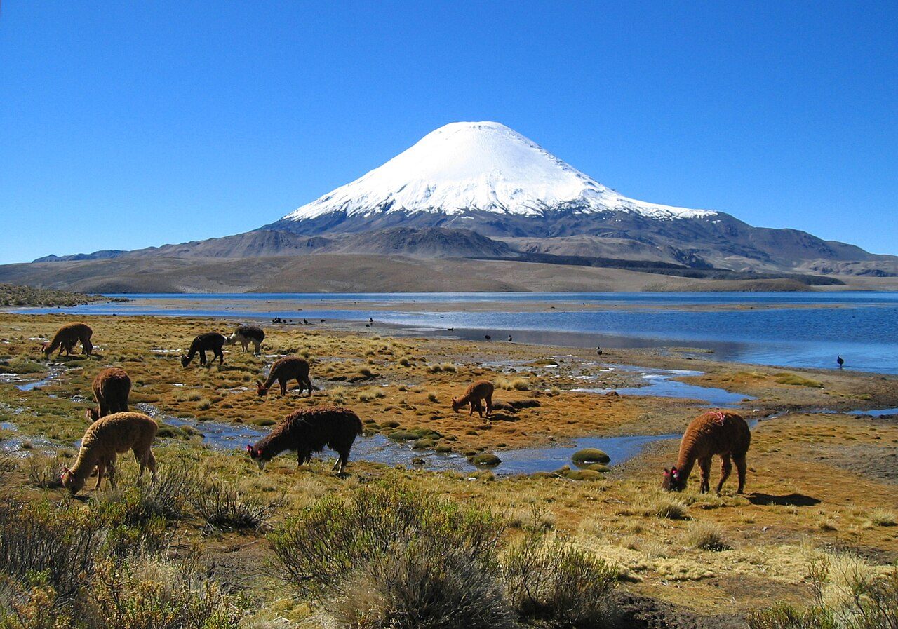
Photo: mtchm from - via Wikimedia Commons, CC BY-SA 2.0. Cropped and resized for display.
Park facts
| Park type | National Park |
|---|---|
| Location | Chile |
| Area | 340,716 acres (137,883 ha) |
| Established | 1970 |
| Highest point | Parinacota — 6,348 m (20,827 ft) |
| Coordinates | 18.2444° S, 69.3539° W |
Every fact above is taken from the sources listed below; anything no source states is left blank rather than guessed.
About Lauca National Park
Lauca National Park is in Chile's Norte Grande (Far North), within the Andean range. It encompasses an area of 1,379 km² of altiplano and mountains, the latter consisting mainly of enormous volcanoes. Las Vicuñas National Reserve is its neighbour to the south. Both protected areas, along with Salar de Surire Natural Monument, form Lauca Biosphere Reserve. The park borders Sajama National Park in Bolivia.
Description from the park's Wikipedia article (CC BY-SA), linked in the sources below.
Planning your visit
What to do
Airports near this park
The airports a visitor would actually fly into, nearest first — each link opens its profile on our sister site AirportProfiles.
- El Alto International Airport (LPB) · La Paz / El Alto, Bolivia · 142.3 miles away
Parks nearby
More parks in Chile

Frequently asked questions
Where is Lauca National Park?
Lauca National Park is in Chile (18.2444° S, 69.3539° W).
When was Lauca National Park established?
Lauca National Park was established in 1970, per the source listed at the foot of this page.
How big is Lauca National Park?
Lauca National Park covers 340,716 acres (137,883 ha).
What is the highest point in Lauca National Park?
The highest point is Parinacota, at 6,348 metres (20,827 ft).
Sources
- https://www.wikidata.org/wiki/Q935435 — Wikidata (CC0) — name, country, coordinates, area, established year, highest point where stated.
- https://en.wikipedia.org/wiki/Lauca_National_Park — Wikipedia article — description (CC BY-SA).