
National Park · Chile
Llullaillaco National Park
Llullaillaco National Park is a national park in Chile, covering 663,971 acres (268,700 ha), established in 1995.
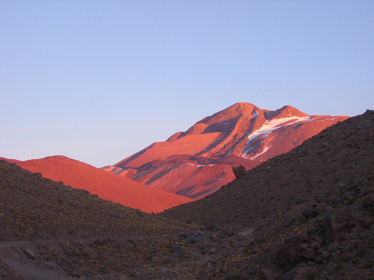
Photo: Lion Hirth (User:Prissantenbär) via Wikimedia Commons, Public domain. Cropped and resized for display.
Park facts
| Park type | National Park |
|---|---|
| Location | Chile |
| Area | 663,971 acres (268,700 ha) |
| Established | 1995 |
| Highest point | Llullaillaco — 6,723 m (22,057 ft) |
| Coordinates | 24.7167° S, 68.6167° W |
Every fact above is taken from the sources listed below; anything no source states is left blank rather than guessed.
About Llullaillaco National Park
Llullaillaco National Park is a national park of Chile, 275 km southeast of Antofagasta in the Andes. It lies between the eastern slopes of the Cordillera Domeyko and the international border with Argentina. In the park there are several important mountains that culminate at the summit of Llullaillaco volcano. The park also is characterized by extensive semi-desert plains interspersed by quebradas (ravines with running water). A part of the Inca road system is found in Río Frío area.
Description from the park's Wikipedia article (CC BY-SA), linked in the sources below.
Airports near this park
The airports a visitor would actually fly into, nearest first — each link opens its profile on our sister site AirportProfiles.
- Andrés Sabella Gálvez International Airport (ANF) · Antofagasta, Chile · 145.0 miles away
Parks nearby
More parks in Chile

Frequently asked questions
Where is Llullaillaco National Park?
Llullaillaco National Park is in Chile (24.7167° S, 68.6167° W).
When was Llullaillaco National Park established?
Llullaillaco National Park was established in 1995, per the source listed at the foot of this page.
How big is Llullaillaco National Park?
Llullaillaco National Park covers 663,971 acres (268,700 ha).
What is the highest point in Llullaillaco National Park?
The highest point is Llullaillaco, at 6,723 metres (22,057 ft).
Sources
- https://www.wikidata.org/wiki/Q1702889 — Wikidata (CC0) — name, country, coordinates, area, established year, highest point where stated.
- https://en.wikipedia.org/wiki/Llullaillaco_National_Park — Wikipedia article — description (CC BY-SA).