
National Park · Chile
Villarrica National Park
Villarrica National Park is a national park in Chile, covering 132,102 acres (53,460 ha), established in 1940.
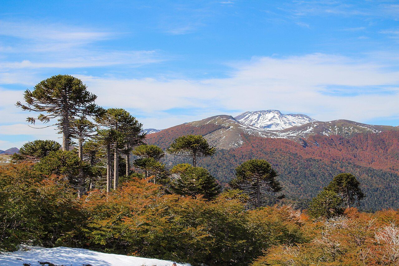
Photo: Natalia Reyes Escobar via Wikimedia Commons, CC BY-SA 4.0. Cropped and resized for display.
Park facts
| Park type | National Park |
|---|---|
| Location | Chile |
| Area | 132,102 acres (53,460 ha) |
| Established | 1940 |
| Highest point | Lanín — 3,776 m (12,388 ft) |
| Coordinates | 39.4931° S, 71.7168° W |
Every fact above is taken from the sources listed below; anything no source states is left blank rather than guessed.
About Villarrica National Park
Villarrica National Park is located in the Andes, in the La Araucanía and Los Ríos regions of Chile, near Pucón. The centerpiece of the park is a line of three volcanoes stretching transversely to the Andean range: Villarrica, Quetrupillán, and Lanín. Other mountains in the park include Quinquilil volcano (2,050 m (6,726 ft)), also known as Colmillo del Diablo, and Cerro Las Peinetas, which lies on the border between Argentina and Chile. It ranges in elevation from 600 m (1,969 ft) to 3,776 m (12,388 ft) at Lanín Volcano.
Description from the park's Wikipedia article (CC BY-SA), linked in the sources below.
Planning your visit
What to do
Airports near this park
The airports a visitor would actually fly into, nearest first — each link opens its profile on our sister site AirportProfiles.
- La Araucanía International Airport (ZCO) · Temuco, Chile · 63.6 miles away
- Teniente Luis Candelaria International Airport (BRC) · San Carlos de Bariloche, Argentina · 118.3 miles away
Parks nearby
More parks in Chile

Frequently asked questions
Where is Villarrica National Park?
Villarrica National Park is in Chile (39.4931° S, 71.7168° W).
When was Villarrica National Park established?
Villarrica National Park was established in 1940, per the source listed at the foot of this page.
How big is Villarrica National Park?
Villarrica National Park covers 132,102 acres (53,460 ha).
What is the highest point in Villarrica National Park?
The highest point is Lanín, at 3,776 metres (12,388 ft).
Sources
- https://www.wikidata.org/wiki/Q606749 — Wikidata (CC0) — name, country, coordinates, area, established year, highest point where stated.
- https://en.wikipedia.org/wiki/Villarrica_National_Park — Wikipedia article — description (CC BY-SA).